- Distance: 155,33 km
- Vertical Ascent: 3.781 m
- No. of Named Cols: <TBC>
- Start Date & Time: 2019-10-16, 11:11
- Start Location: Campan
- End Date & Time: 2019-10-17, 02:28
- End Location: Arette
- Time Moving: 10:30:08
- Moving Average: 14,8 km/h
- No. of Stops >3 Minutes: 17
Data: strava.com/activities/2795034311

On the morning of what had to be the penultimate day of the journey, I was in a similarly great mood as when leaving the Grand Hotel de Paris in Amélie-les-Bains a few nights prior. The spontaneous yet so friendly reception at both places, and by both hosts — Lionel here in Cayres-de-By/Campan, Jean in Amélie-les-Bains — made all the difference:
Throughout the year and across the seasons, the Hôtel Le Chalet specializes in sports tourism, and from what I’ve seen on site and later on Tripadvisor, their focus appears to be on cycling, including serving larger groups of cyclists.
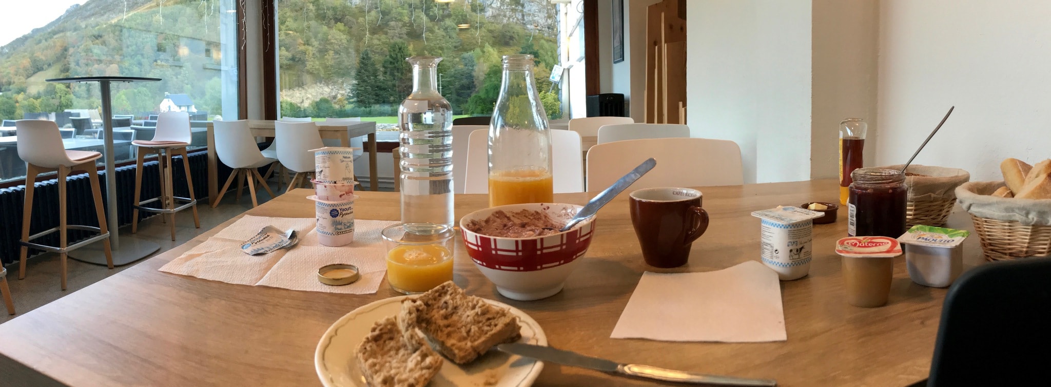
But to me, the human, personal aspect of any moment in life is always the most important. And while other hosts had been exceptionally forthcoming too, Lionel was another extremely positive chance encounter. I had neither called in advance nor in another way reserved before arriving. And then to get room 42 and a “royal” treatment as the only guest … still not completely over it, and had to take extra time for breakfast to properly stretch this experience.

After eventually leaving breakfast table and hotel, I knew the first climb of the day would be nothing less than the Tourmalet. Therefore I took it slow. Not long, and I could already rid myself of the warmer outer layer. Another half an hour later I paused for a few pictures, and to further change into my ultralight climbing kit, when and a group of road cyclists approached, also from direction of Campan. I briefly wished for company on the climb ahead, just like yesterday up to Garin from Bagnères-de-Luchon, but the group didn’t stop or even relent their impressive speed. Clad in more or less uniform kit, smiling and waving while passing, they had to be from a Spanish team or cycling club. (Note: thanks to Strava FlyBys I tracked them down as being from the Donóstia region of the Spanish Basque country and of or affiliated with “BPXport Kirol Klubla”.)


The climb up the Tourmalet from Sainte Marie de Campan is classified as “HC” on Strava, with 17,27 km at an average gradient of 7% for a vertical ascent of 1.249 metres. And it felt exactly like this. Not too long, not too steep, around three times the length and vertical ascent of my favorite climb “Weißer Stein (B3 -> Waldkreuzung)”, about 20 kilometres from my home in the city of Mannheim in Germany. That climb in turn is classified as Cat. 2.
And so I did what I always do with longer or supposedly difficult climbs. In my mind, I split them into multiple instances of the “Weißer Stein”. For the Tourmalet this meant three times the the duration plus probably an extra margin for total length and photo stops.
Altogether, the Tourmalet was by far not as taxing physically as I had expected: It progresses at a relatively steady gradient, on almost pristine tarmac. The views along the way were nice but didn’t excite me that much after more than ten days in the Pyrenees (yet I still paused for some pictures). And while I was briefly tempted to stop for a snack and coffee at the resort town of La Mongie, I didn’t really need either. And I cannot help but prefer the smaller, less perfect roads and less touristic places.
Reaching the summit of the Tourmalet felt great nevertheless. And, to be fair, I climbed in probably the best conditions: On a relatively sunny day, from the east, in the late morning, which meant that temperatures were relatively constant (the relative rise in temperatures over the course of the day was compensated by the altitude increase throughout my ride). There were pictures and stories of other TPR riders having passed the Tourmalet at night or in the early morning hours and in fog or rain. And even though temperatures had dropped significantly over the past days, the good weather had returned and the sun is still strong enough in Mid-October to allow my choice of ultralight climbing kit, in turn preventing me from overheating.
As usual, I crossed the white line on the road marking the summit and deliberately rode an extra few meters before turning around and leaning my bike against the wall underneath the well-known monument to Octave Lapize.


A strong wind blew in my face and everyone around was either wearing thick winter clothes or changing into them: A few people on road bikes, an older gentleman on an e-mountain bike, and a film crew was busy working on a shot with presumably a pro cyclist I did not recognize. They were running around between their vans and the café/souvenir shop on the north side and the restaurant on the south side of the road, flying a camera drone and vividly discussing something I didn’t catch at all. Nevermind, I also put on some warm layers and my rain gear for extra protection from wind chill and set out to descend the next 40+ kms to Argelès-Gazost.
Descending was an exhilarating experience. I don’t remember much, except for the fact that I held on very tight to my handlebars and just let go. While I had reached higher speeds on the Eje Pirenaico back during the second night of the TPR, on my way to Aínsa, now racing down on a still significantly smaller road in broad daylight was different.
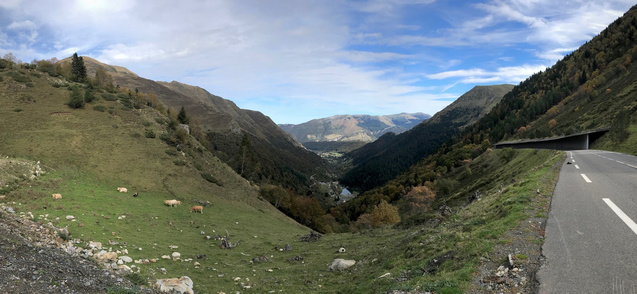
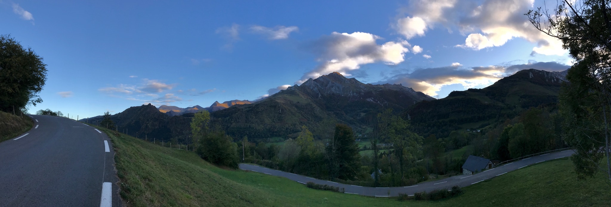
At exactly half the way down to the Gave river valley there was a short break in the descent where the D12a from Luz-Saint-Sauveur crosses the river Gave (here it’s the “Gave de Gavarnie”) on the old Napoleon Bridge to again meet the D921. The view down the valley is spectacular, especially considering having left he high mountains atop the tree line just moments ago. From here, the route descends at moderate but varied gradients along the Gave de Pau.


On reaching Argelès-Gazost, I exited the D100 at the first roundabout and at the second roundabout noticed two cyclists, when the woman called me by my name. It were Niamh and Mark from the Pyrenees Cycling Lodge who had managed to time their afternoon ride with mine — and I was easy to identify by my cap number.
We had a short conversation before Mark returned to the lodge and left Niamh and me. We continued on the official TPR route to downtown Argelès-Gazost to find a boulangerie where I would resupply for the long ride ahead and both of us could sit down for a coffee break. Going to the lodge together would have meant too long a detour for me. As I wasn’t really racing the TPR any longer I was totally relaxed and enjoyed the company, but Niamh encouraged me to get back on the road if I really wanted to do the remaining big cols of the Raid Pyrénéen tonight.
Niamh and me parted ways at the boulangerie where I’d packed enough pastries and pizza to feed a small team. But I didn’t want to stop to resupply again, before the finish, except for water and coffee. So I carried a pretty heavy mesh bag on my back that would only get lighter over time and the more I’d exert myself and then refuel.
I had decided to at least climb the cols de Soulor, Aubisque and Marie Blanque and then continue a bit further into French Basque Country, concluding today’s ride at something between 150 and 160 kilometres. This would then leave a safe effort of about the same distance but less vertical ascent for the final day of my ride.


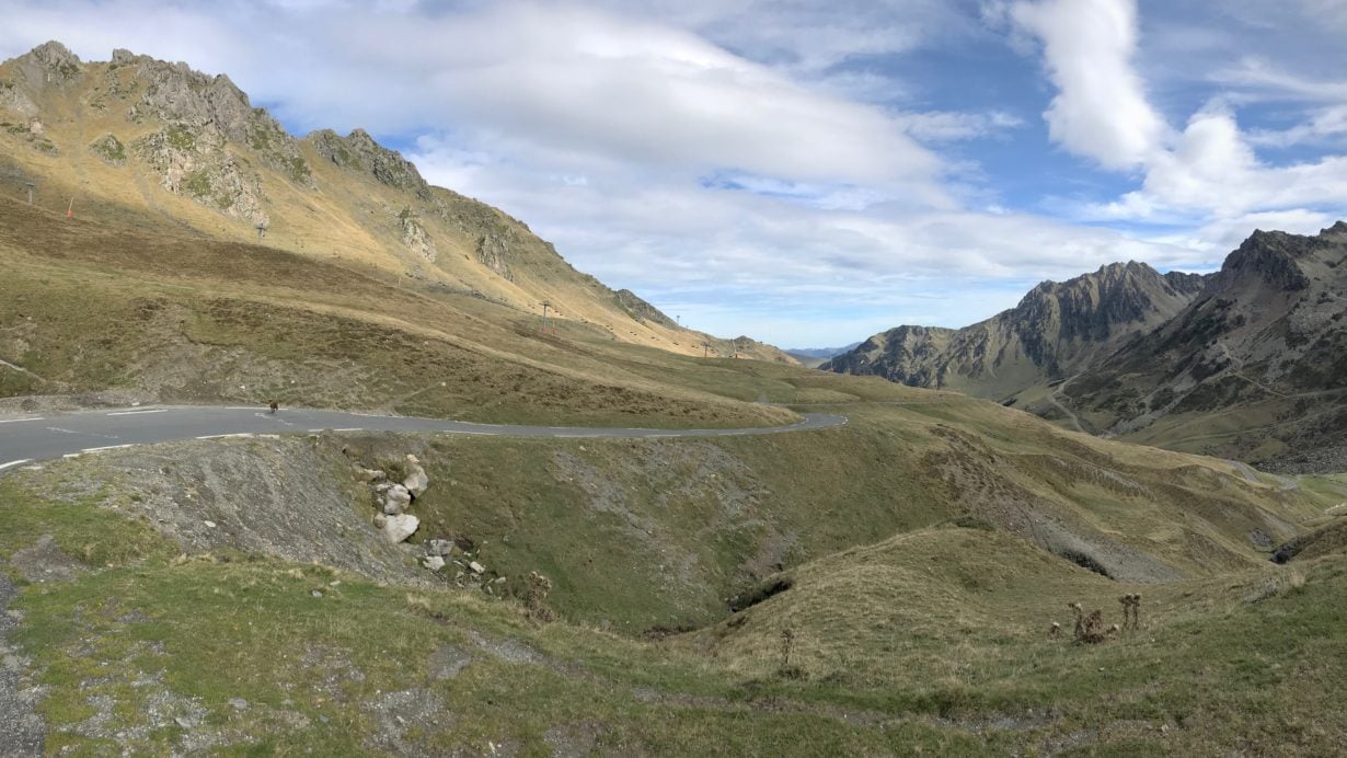
The ride up to Col du Soulor went on until sunset as the route wound its way through the beautiful countryside. I observed a “Gite” set against a gently sloped hill that was being remodelled — while neighbouring structures had obviously been similarly restored earlier. Altogether the climb was nice, but I had only just cycled half of what I had planned for the day. The subsequent shallow ascent from Soulor to Aubisque over the narrow, sinuous D918 gave me goosebumps, maybe for the cool of the night, or because of the remoteness of these places and the many curves and hairpins. Niamh’s reminder to be extra careful on these balcony roads with little to no protection may also have contributed.
A while earlier, I had booked my place for the night in the appropriately named town of Arette, at the Hôtel de l’Ours. The woman on the phone had arranged for my late arrival, and as Arette lay perfectly on the official itinerary I would achieve my goal for the day without any detour. Now, only the Col de Marie Blanque remained to be conquered.
Descending from the Col d’Aubisque via Gourette was fast and on a good road, and everything practically flew by so quickly that I completely missed the exit to the D240 just on the limits of the spa town of Eaux-Bonnes. Still on the D918, I chased a fox for a few hundred metres until it disappeared into the trees and I finally turned the bike around, retraced my way and then found the proper route. The first section until Assouste reminded me somewhat of the old road to Escouloubre on day nine, but altogether I was in a much better shape now.
After Assouste, between Aste-Béon and Bielle, I stopped on the side of the D40 to grab some pastries from my musette and also just to not pedal for a minute or two. It was one of the first moments of tiredness, yet only 50 kms remained for me to ride into the night. Leaning the bike with front and tail lights brightly lit against the supporting wall of a house built into the hillside I packed away the rest of my rain gear. Again, a complete GoreTex layer had kept me warm descending from the Cod d’Aubisque. I knew I was just one or two kilometres away from the final climb of the day/night, and also, down here at significantly lower altitude it was actually quite mild — not by far as cold as the evenings and nights before. Even though the sky was mostly clear with a waning moon still drawing sharp contours of trees and bushes on the roads, I could change back into light kit for supposedly the last tough climb of the TPR.
I had not been standing there for long when a car pulled up beside me. It was a patrol of the Gendarmerie, and they were quite inquisitive. By now it must have been around 11:00 pm, and although I only felt a bit tired, the officer behind the wheel looked sincerely concerned about my safety (and sanity?) when I explained my intention to cross the Marie Blanque and continue to Arette. But they must have seen far worse with the rich French cycling culture all over the place. The patrol car drove off, and I decided it was probably a good idea to also leave the valley and push on towards my goal of the day.


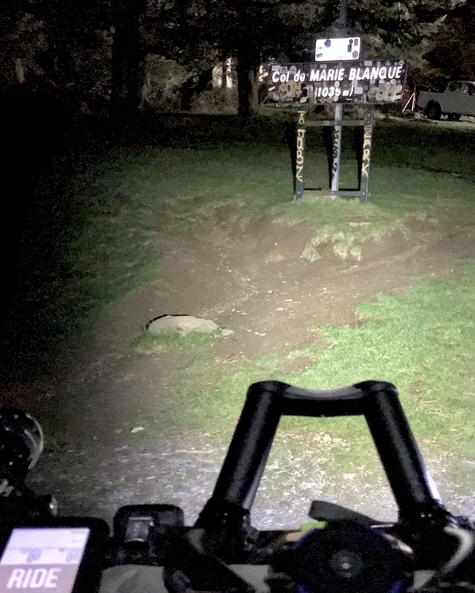
Depending on the Strava segment you look at, the Marie Blanque climb has a gradient of 5% over 10 to 11 kms. This corresponds to a Cat. 2 climb ascending around 560 vertical meters. Nothing big. Not really. My favorite “Weißer Stein” climb at home from the figures alone looks harder as it’s steeper. But I remember the Marie Blanque as one of the most challenging climbs of this TPR — and the entire ride as one of the most memorable:
The climb starts on the north-western outskirts of the ancient village of Bielle. Again, I was reminded of several other places I had passed over the course of the TPR, where a rich legacy of old buildings from various centuries, at least in part seemingly preserved in their “original” context made me wish to return during daytime to truly take in and study everything. Now, at night, I swiftly rolled through the narrow streets and up onto the D294.
From Bielle, the first roughly six kilometres to the Col de Porteigt constantly vary ever so slightly between about 6% and 11%, including a short ramp of 15%. This is followed by the perfectly flat Plateau du Benou. Then another ramp of 8-11% precedes a false-flat section immediately thereafter, before the final short climb leads up to the summit. These frequent yet irregular, completely random changes in gradient wore me down.
But I remember thinking on more than one occasion that the next time I ride this climb at night, I need to bring suitable audio recording equipment: Sometimes it’s the rushing of water, then the calls of owls and other birds, later the clang of bells of all sizes … and in between all this the quiet rolling sound of my tires over tarmac, occasionally pierced by the noise of shifting gears. And if the soundscape is not enough, the changes in landscape between mountainous climbs, rolling hills and forest should provide enough variety for everyone.
When I rode by the free-roaming horse peacefully trotting along the road on the Plateau du Benou, while all around bells of cows or other horses clang loudly, I was so happy that I could have just stopped and stood there forever. But I pressed on until reaching the summit, where I came across another crew of people with multiple vans and generators with lots of cables and floodlights, tents and other equipment. Possibly another film crew?! They were busy and kept their distance. Me too.
From the Col de Marie Blanque some 25 kms remained to Arette. I would stop once more, at the public fountain in Issor, to already refill the water bottles for the next day: Three items less to take with me to the hotel room and to handle in the morning. From here to the Hôtel de l’Ours just a tiny hill remained to overcome before my last night in the Pyrenees.