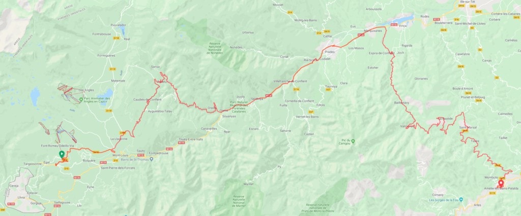
- Distance: 132,61 km
- Vertical Ascent: 1.717 m
- No. of Named Cols: <TBC>
- Start Date & Time: 2019-10-09, 10:15
- Start Location: Font-Romeu-Odeillo-Via
- End Date & Time: 2019-10-09, 21:58
- End Location: Amélie-les-Bains-Palalda
- Time Moving: 7:03:22
- Moving Average: 18,8 km/h
- No. of Stops >3 Minutes: 14
Data: strava.com/activities/2767351189
Started out relatively early from Font-Romeu-Odeillo-Via. Of course I had previously had a few helpings from the breakfast buffet, and also taken advantage of the latter to resupply for the road. Although it’s now less than 24 hours until the time cut, and even making it to Biarritz for the Finishers’ Party is out of the question, my decision stands: I will stick to the official race manual, rules, CPs, parcours and everything. And I won’t quit, or “scratch”, as it is called, when you leave the race (and prematurely end the journey) — for whatever reason.
To begin my journey of the day in accordance with race rules, I took some side streets down to the official start of Parcours B. This brought me to a vantage point overlooking the world’s largest solar power furnace in Odeillo. The sun was out in force, but an icy wind reminded me that it’s October, and I’m in France’s oldest winter sports resort.
I had put on the long sleeve merino base layer and my Recon vest, a combination that had proven perfect for climbing and descending on cold mornings. Passing through a landscape peppered with granite boulders of all sizes Parcours B went up and down, first on the D618, then D118 and eventually on the D4c over the Col de la Llose before descending through a wooded area in direction of Ayguatébia-Talau.
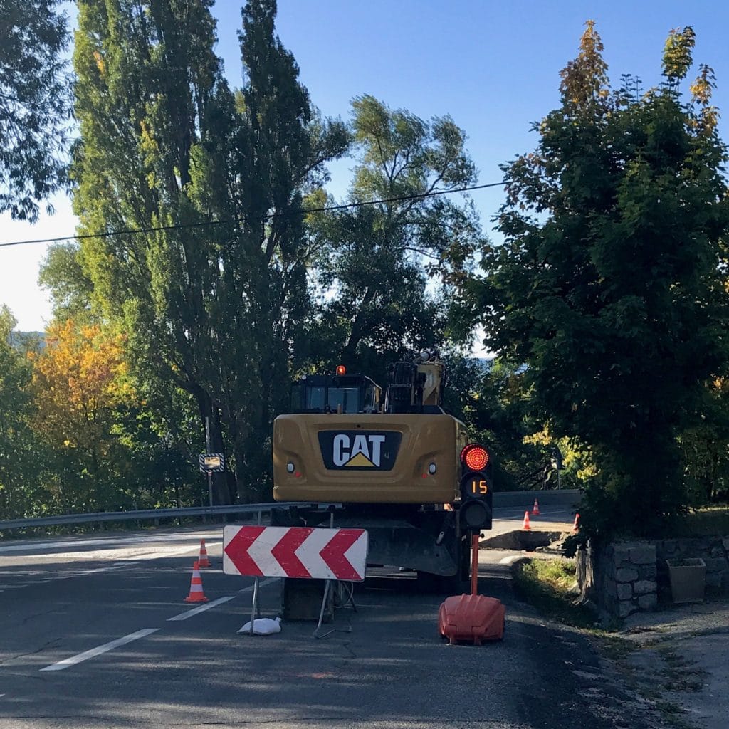
But, just after Mas Sidou, signs indicated that Parcours B was blocked: “Route barrée” (which in France means it’s actually closed … if it only signals a “Deviation” without the “Route barrée” sign, you most certainly will be able to pass, albeit often with a provisional traffic light regulating transit around roadworks: “Circulation alternée”) — And the moment I turned left to take the deviation via Caudiès-de-Conflent on the Route de Railleu, weather also turned. A thick layer of clouds crept in from the east, blocking out the sun and quickly pulling temperatures down.
Some kilometres into the new route, there was an option to return to Parcours B on a still smaller, unserviced road. I didn’t dare take that one, for (a) not knowing if that then brought me to a section before or after the road closure, and (b) for the fact that when in France, and roads are signalled as being of poor quality, one should rather heed that call! Although my romantic self had originally plotted a course for the TPR that avoided the stress from heavy traffic on larger roads, by now I had to acknowledge the time savings those could provide. Especially when a significant portion of the race had to be done on gravel or otherwise slower terrain, the main thoroughfares offered time savings and a relief from constant high alert with the prospect of hitting potholes, rocks and gravel.
I made my way along the D4f, and gradually put on more clothes. In Railleu I left the main road and headed into the village, looking for a coffee stop but didn’t find one: A common theme while riding in the French Pyrenees was the utter scarcity of small shops and bars. Yet the scenery I passed made up for all shivers, hunger and gritted teeth.
Leaving Railleu the D4f began to descend and a short while later merged into the D4. The balcony road was flanked by either naked or overgrown rocks and wooded hills on one side or wonderful views of the valley to the east. I would follow the Rivière de Cabrils until the end of the parcours, where its waters are absorbed by the more prominent Têt river. The road surface was a mix of fresh “Gravillons”, half-baked chip seal and smooth tarmac, frequently turning sharply on small bridges over even smaller tributaries of the tiny stream in the valley below. I was careful not to race downhill. My route rejoined the official itinerary of Parcours B, and if not for a very close encounter with of one of those humongous white SUVs, I’d even say I enjoyed the final stretch into the town of Olette. The valley certainly was beautiful, but for the first time during this TPR, I grew tired of hairpin turns with low to no crash barriers.
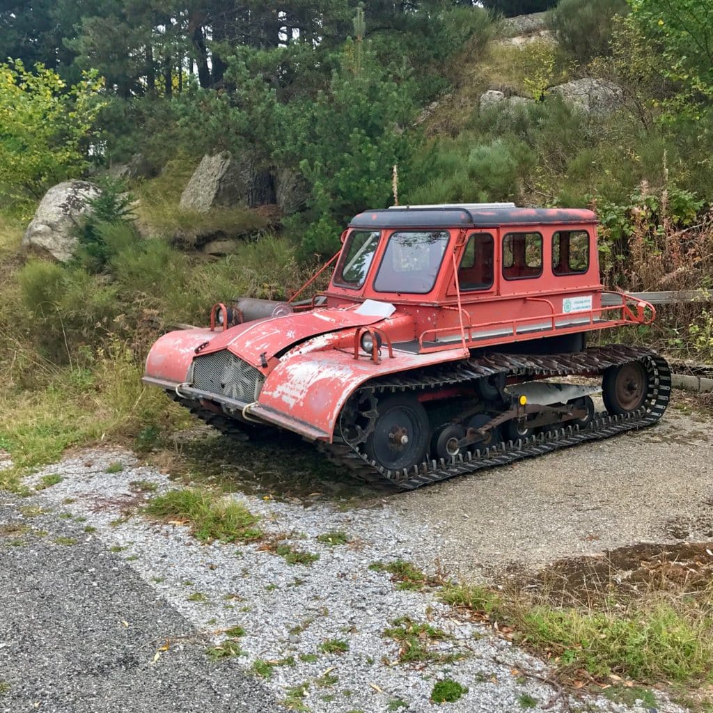
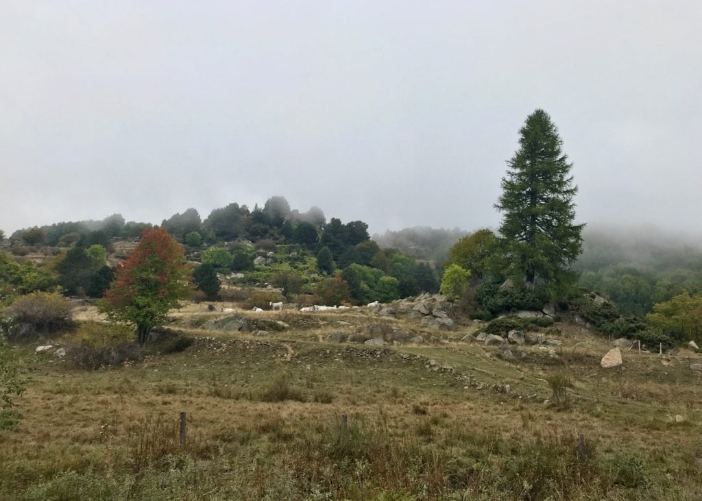
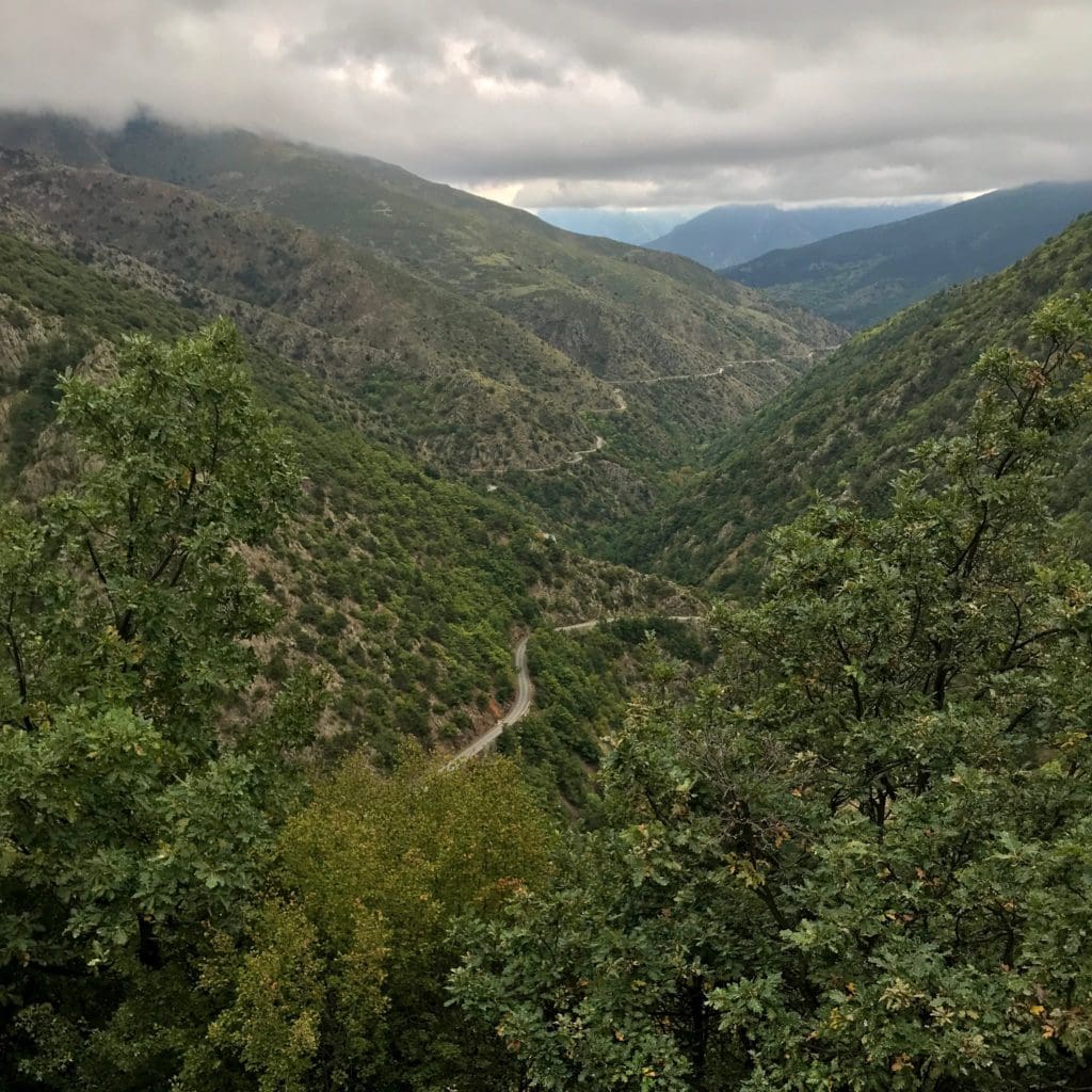
By the end of Parcours B temperatures rose as rapidly as they had dropped, yet I still longed for a hot meal somewhere inside and a good coffee to conclude the break. In Olette, about 150 meters down the main road on the right hand side, I found a bar and parked my bike outside on the small strip of concrete pavement.
A single, huge room lit by natural light shining through tall windows from a backyard housed a long, stainless steel counter to the left, simple tables and chairs to the right and stretching far into the back. Frequented by workers on lunch break and probably other locals, it was decorated with dated posters of holiday destinations, soft drink adverts and whatnot. The location radiated the down-to-earth appeal of a place not-in-the-slightest targeting tourists, let alone foreign customers.
Nevertheless, the girl behind the counter, likely the owner’s daughter, was super-nice and made me a fabulous Catalán salad and spicy bruschette. A bit overpriced for the appearance of this establishment, it satisfied my hunger, heated me up from the inside and made me happy. In hindsight though, I could have stayed away from the coffee.
From Olette I followed the N116 eastwards, under a still overcast sky, and at Ria-Sirach experimented with an alternative to the busy national road, but to no avail. Another couple of minutes lost.
Meanwhile weather and the prospect of Parcours C with a long climb to la Bastide had me change into lighter kit. And again I lost the “flow” and a lot of time in the process: I have to find ways to optimize “rituals“ like this. And also the way I store clothes on the bike needs to be more efficient. And I must practice more, and then also stick to proven routine!
By now the Mediterranean was practically within reach. But after leaving behind the busy city of Prades on the banks of the Têt, creative TPR architects had placed another task between me and the sea:
Parcours C began just outside the minuscule town of Finestret. To reach the start location, I had plotted a route along the local cemetery and then via a tiny rural alleyway. — Everything around me was green! From the moment I left the village and until night would obliterate all colors. This impression was certainly helped by a light drizzle and the still gray sky.
Not far from neither sunset nor the passive control (code book), I reached Valmanya and, on the right side of the D13, just before crossing the Lentilla stream, noticed a rock with a cave or tunnel entrance bearing a date from the year 1944. This immediately sparked my curiosity, and as I had to change into warmer kit for the night I did a search on Wikipedia. Turns out, the entire valley and region of the Canigou have a long history in iron mining. And during World War II the old mines and the mountainous area close to the border as a whole served as an important base for the French Resistance and Spanish guerilla. Eventually betrayed by an informant, on August 1 and 2, 1944, the Germans undertook a raid on the Maquis network. Despite the attack being partly held-up by resistance fighters, and local population thus given time to flee, villagers who had not been able to make it into the mountains were murdered, Valmanya largely destroyed, and alleged collaborators were detained, tortured and deported.
Deep in thoughts over this grim history lesson I almost forgot to stop for the passive control for Parcours C, only a short distance further down the D13. But having “favorited” locations of all CPs and code books in Apple Maps on my iPhone, the road marker of km 33 could not be missed. Bright orange tangerine peels on the ground were proof that this spot had been popular recently. And as others before me I reported my individual code back to Jon Endres at the TPR Helpline.
From here on, dusk crept in from everywhere and turned to darkness not long after. Passing the top of the climb, the Col de Palomère, I had a vague hope of seeing the Mediterranean on the horizon. But apart from it being far too dark and cloudy, I think I underestimated the expanse of the littoral range of mountains and hills making up the Pays Catalán on the French and Catalunya on the Spanish side.
Arriving at the village of La Bastide, the finish of Parcours C, darkness had fallen around me, and I stood by my decision from before the start of the TPR to spend the night in Amélie-les-Bains, a spa town, situated perfectly en route to CP3. Already in January, I had “scouted” the place via satellite images and on Google StreetView. Plenty of hotels, hostels, bars and restaurants. This should be a piece of cake of a hunt for a bed, dinner and breakfast.
As it turns out, the final hours of today merit their very own story and blog entry:
Please grab a drink (maybe even a glass of red wine), and enjoy — “The Most Unexpected”.
